Enhanced Yield Prediction with Remote Sensing
The agricultural industry is no stranger to uncertainty, but what if you had a crystal ball that could predict yield with remarkable accuracy? Imagine being able to anticipate the needs of your crops before they knew they needed it. Welcome to the world of remote sensing technologies for yield prediction, a game-changer for modern farming. These innovative tools provide the clarity and precision that farmers need to make informed decisions, optimize resources, and maximize crop productivity. Let’s dive into how satellite imagery and remote monitoring techniques are transforming agricultural yield forecasting.
The Power of Remote Sensing in Agriculture
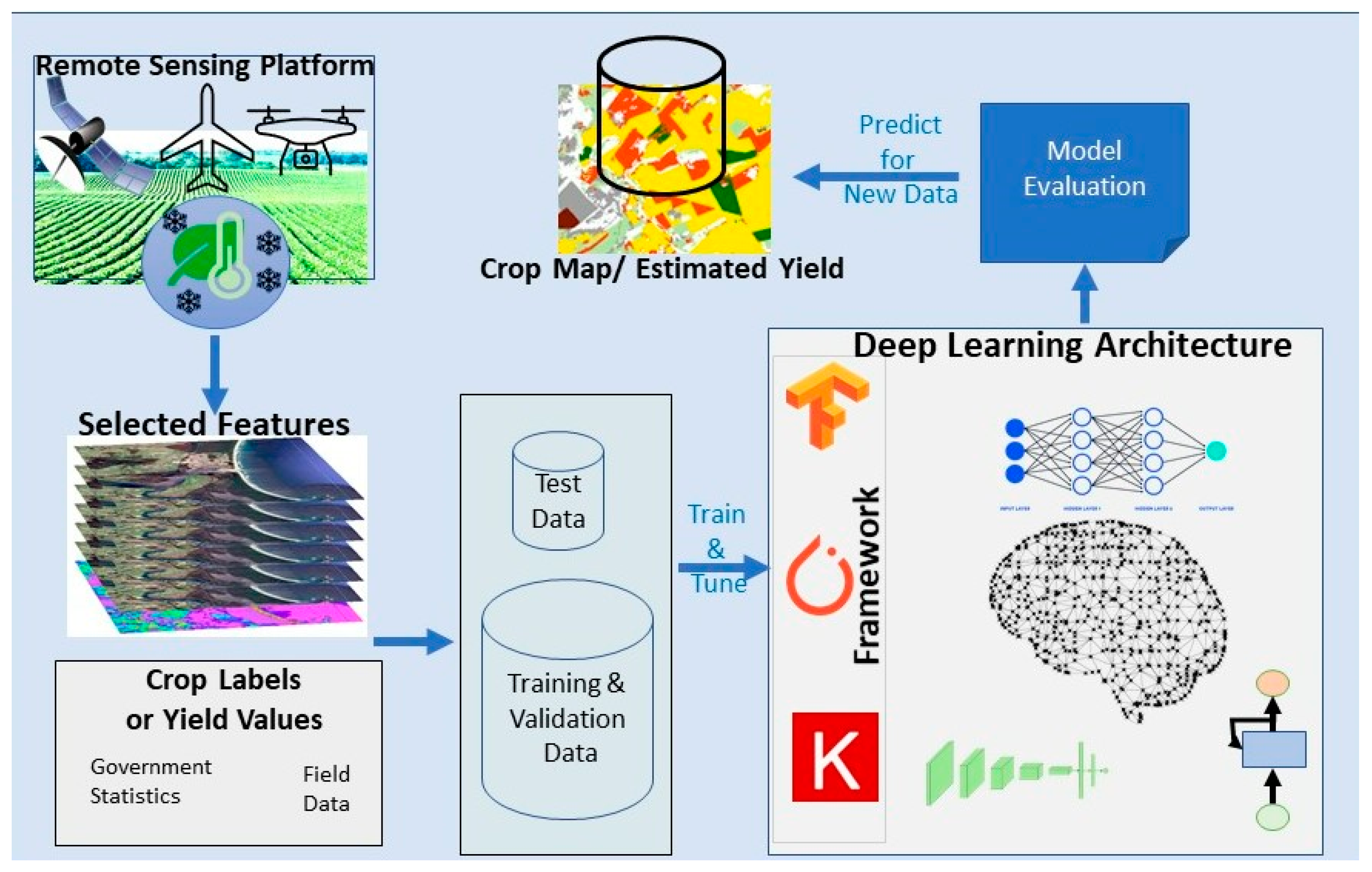
Remote sensing has emerged as a pivotal tool in agricultural sensing, enabling farmers to monitor their fields from a bird’s-eye view. This technology uses satellite imagery and other sensors to collect data on various parameters, such as soil moisture, nutrient levels, and crop health. By analyzing this data, farmers can predict yields more accurately, leading to better planning and sustainability in farming practices.
But how exactly does this work? Think of remote sensing as a sophisticated eye in the sky. Just as a doctor uses an MRI to examine the internal workings of the body, farmers use satellite imagery to examine the internal workings of their fields. These images provide invaluable insights into the health of crops, allowing farmers to take proactive measures rather than reactive ones.
Understanding Satellite Imagery
Satellite imagery is the cornerstone of remote sensing technologies for yield prediction. Equipped with multispectral and hyperspectral sensors, satellites capture detailed images of agricultural fields at different wavelengths. These images can reveal information that is not visible to the naked eye, such as the presence of pests or diseases, soil nutrient deficiencies, and water stress. By harnessing this data, farmers can make data-driven decisions that optimize resource use and enhance crop productivity.
One of the key benefits of satellite imagery is its ability to provide real-time data. This is akin to having a live feed of your fields, allowing you to monitor changes in crop health and environmental conditions as they happen. Real-time data is invaluable for agricultural yield forecasting, as it enables farmers to adjust their strategies on the fly, ensuring that their crops receive the care they need when they need it.
Remote Monitoring Techniques
Remote monitoring techniques go hand in hand with satellite imagery, providing a comprehensive view of agricultural activities. These techniques use various sensors, such as drones and ground-based stations, to collect data on multiple parameters. For example, drones can capture high-resolution images of fields, while ground-based stations can measure soil moisture and nutrient levels. By integrating data from these sources, farmers can gain a holistic understanding of their fields, leading to more accurate yield predictions.
Consider this analogy: remote monitoring techniques are like a symphony orchestra, where each instrument plays a crucial role. Satellite imagery provides the melody, drones offer the rhythm, and ground-based sensors add the harmonies. Together, they create a symphony of data that allows farmers to predict yields with precision and confidence.
Advancements in Agricultural Yield Forecasting
As remote sensing technologies continue to evolve, so too do yield prediction methods. Modern farmers have access to a suite of advanced tools that can revolutionize their forecasting capabilities. These tools leverage machine learning algorithms, AI, and big data analytics to process vast amounts of data, identifying patterns and trends that would be impossible to detect with traditional methods. By integrating these technologies, farmers can achieve unprecedented levels of accuracy in their predictions, leading to better planning and resource management.
But why should you care about these advancements? The answer is simple: sustainability. In an era of climate change and increasing resource scarcity, sustainable farming practices are more important than ever. By leveraging remote sensing technologies for yield prediction, farmers can reduce waste, conserve resources, and enhance the sustainability of their operations. Imagine being able to predict exactly how much fertilizer your crops need, or when to irrigate them. This level of precision can lead to significant savings in costs and resources, while also boosting crop productivity.
The Role of Machine Learning and AI
Machine learning and AI are at the forefront of agricultural yield forecasting. These technologies can analyze vast amounts of data, identifying patterns and trends that would be invisible to the human eye. For example, machine learning algorithms can detect subtle changes in crop health, enabling farmers to take proactive measures before problems escalate. AI, on the other hand, can simulate various scenarios, helping farmers plan for different possibilities and make informed decisions. The integration of machine learning and AI into remote sensing technologies is transforming agricultural yield forecasting, making it more reliable and accurate than ever before.
But how do you get started with these technologies? The good news is that you don’t need to be a tech whiz to leverage the power of remote sensing. Many agricultural platforms offer user-friendly interfaces that make it easy to access and analyze satellite imagery and other data. These platforms often come with built-in analytics tools that provide actionable insights, helping you make informed decisions about your crops.
Leveraging Real-World Examples
To understand the real-world impact of remote sensing technologies, let’s look at a few success stories. Farmers around the globe are already reaping the benefits of these innovative tools, achieving remarkable improvements in yield prediction and sustainability.
Case Study: Precision Agriculture in California
In California, farmers are using remote sensing technologies to achieve unprecedented levels of precision agriculture. By analyzing satellite imagery and drone data, these farmers can monitor crop health, soil moisture, and nutrient levels in real-time. This allows them to make data-driven decisions, such as adjusting irrigation schedules and fertilizer applications, leading to significant improvements in yield and sustainability.
The results speak for themselves: farmers in California have reported a 20% increase in crop yields and a 30% reduction in water usage. These gains demonstrate the transformative power of remote sensing technologies, showing how they can be used to enhance yield prediction and drive sustainable farming practices.
Case Study: Smart Farming in Europe
In Europe, smart farming is taking agriculture to the next level. By integrating remote sensing technologies with IoT sensors and AI, European farmers are achieving remarkable improvements in yield forecasting. These technologies allow them to monitor their fields in real-time, making proactive decisions that optimize resource use and enhance crop productivity. As a result, European farmers have seen a significant increase in yields and a reduction in costs and environmental impact.
Consider this analogy: smart farming is like a highly efficient assembly line, where every component works in harmony. Remote sensing technologies provide the raw data, IoT sensors add the granular details, and AI processes it all, delivering insights that drive better decision-making. This integrated approach is revolutionizing yield forecasting, making it more reliable and sustainable than ever.
Embracing the Future with Remote Sensing
As we stand on the cusp of a new era in agriculture, remote sensing technologies are poised to play a pivotal role. By leveraging satellite imagery and remote monitoring techniques, farmers can achieve unprecedented levels of precision in yield prediction, leading to better planning and sustainability. But how can you get started with these technologies?
The first step is to educate yourself about the various remote sensing tools and platforms available. There are many resources and guides online that can help you understand the basics and get started. Next, consider investing in satellite imagery and remote monitoring technologies tailored to your specific needs. Work with experts who can help you integrate these tools into your existing operations, ensuring that you get the most out of your investment.
But remember, technology is just a tool. The real magic happens when you combine it with your expertise and experience as a farmer. By leveraging remote sensing technologies for yield prediction, you can take your farming practices to the next level, achieving greater precision, sustainability, and profitability.
In conclusion, remote sensing technologies are revolutionizing yield prediction in agriculture. By providing accurate and timely data, these innovative tools enable farmers to make informed decisions, optimize resource use, and maximize crop productivity. From satellite imagery to remote monitoring techniques, these technologies offer a wealth of opportunities for enhancing yield forecasting and driving sustainable farming practices. Embrace the future with remote sensing and unlock the full potential of your crops.
ready to revolutionize your farming practices? Click to learn more about how remote sensing technologies can enhance your yield predictions and ensure a bountiful harvest every season.
Frequently Asked Questions
What is remote sensing technologies for yield prediction?
Remote sensing technologies for yield prediction use satellite imagery and other sensors to collect data on various agricultural parameters, such as soil moisture, nutrient levels, and crop health. By analyzing this data, farmers can make informed decisions that optimize resource use and enhance crop productivity.
How do satellite imagery and remote monitoring techniques work?
Satellite imagery captures detailed images of agricultural fields at different wavelengths, providing valuable insights into crop health. Remote monitoring techniques, such as drones and ground-based sensors, collect data on multiple parameters, allowing farmers to gain a holistic understanding of their fields.
What are the benefits of using remote sensing in agriculture?
The benefits of using remote sensing in agriculture include improved yield prediction, better resource management, enhanced sustainability, and increased profitability. These technologies enable farmers to make data-driven decisions that optimize crop productivity and resource use.
How can farmers get started with remote sensing technologies?
Farmers can get started with remote sensing technologies by educating themselves about the available tools and platforms. They can then invest in satellite imagery and remote monitoring technologies tailored to their specific needs and work with experts to integrate these tools into their existing operations.
What impact do remote sensing technologies have on farming practices?
Remote sensing technologies transform farming practices by providing accurate and timely data that enables informed decision-making. These technologies help farmers optimize resource use, enhance crop productivity, and achieve better planning and sustainability.

0 Response to " Enhanced Yield Prediction with Remote Sensing"
Post a Comment